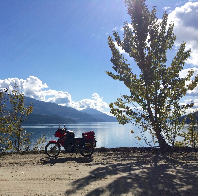
| Looking east across Upper Arrow Lake at Telegraph Bay, Highway 23, and Nakusp, from the FSR along the west shore. Today's agenda was to track west and south to Nelson, BC, on a mix of busy highway, logging roads, and quiet & twisty highway. Overall, mission accomplished, although I modified my route midway along due to remaining daylight and an equipment failure. |
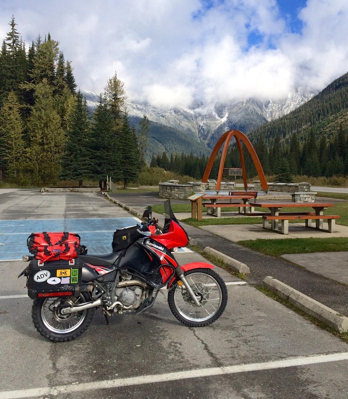
The day started cool, and in valley fog from Golden until probably a third of the way of the climb up towards Rogers Pass. Fortunately the fog had lifted by the coldest temperatures at the summit, and I didn't face any issues of visibility or icing (neither on the road nor in my helmet). Then it happened.
16 km before Revelstoke, I saw another bike. A geared up, travelling KLR, no less! By my calculation, that was 2,071 km into the trip. Crazy. (I saw several more later in the day, throughout the moto highway mecca around Nakusp-Kaslo.)
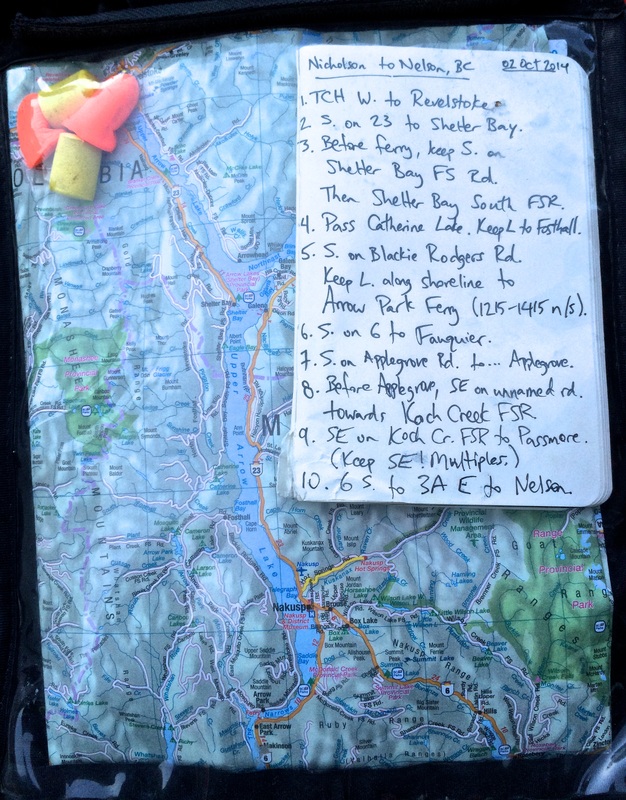
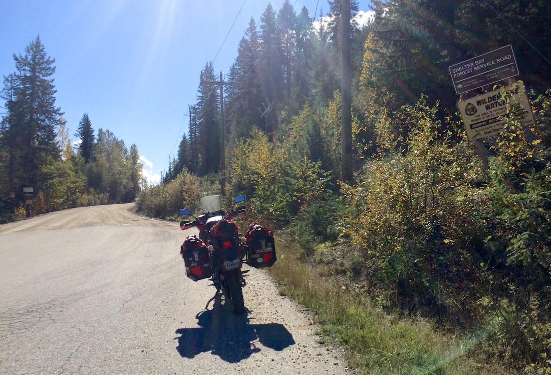
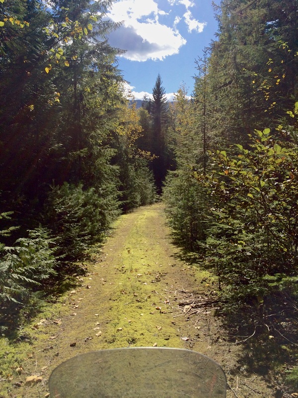
In Revelstoke, I stopped for gas, a real map, and a warm bowl of soup. I headed south down 23 towards Shelter Bay, then stayed on land at the Shelter Bay-Galena ferry, continuing south along the west shore of Upper Arrow Lake on the Shelter Bay Forest Service Road. Navigating the FSR network proved to be just the right amount of challenge; I turned off-track a total of five or six times, all at unmarked forks, but was always able to figure it out within 2-5 minutes based on heading or degrading road condition. There was more traffic than I expected, most of it 'industrial,' and twice I stopped to ask the loggers 'Which way south?' Oh, the loggers? Not logging trees. Logging mushrooms. Yeah, there were mushrooms everywhere in the bush -- in the Fosthall region if anyone's really keen -- and it seemed to be the leading industry in the area for retirees and French-Canadian twentysomethings. I tried to swerve around them all, okay guys?
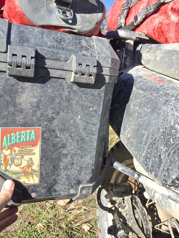
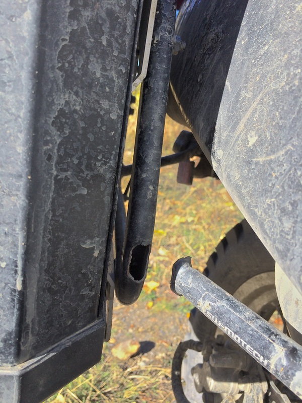
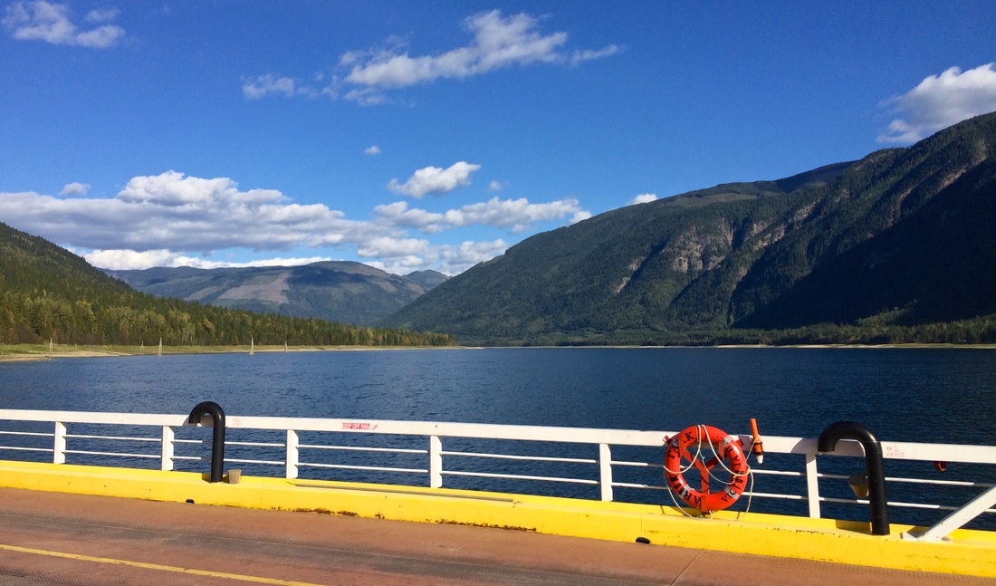
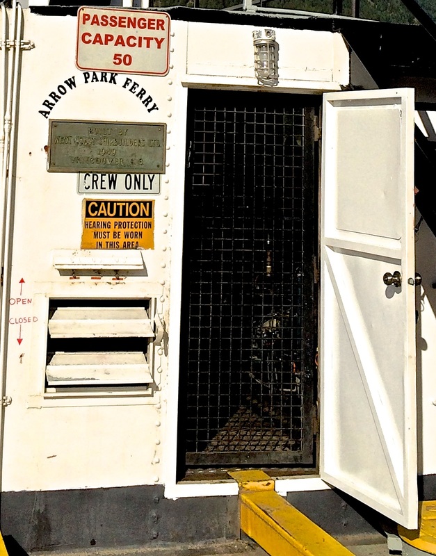
The route (when I was on it) was great. Very scenic, generally cruising in second and third gear with the occasional spurt of fourth. I stopped at a scenic overlook across from Nakusp to take a picture, have a scenic pee, and discover that one of my luggage racks had broken at a weld -- leaving my right pannier flopping almost in the wind. I transferred most weight over to the left side, then re-secured the pannier with a bolt, two Rok Straps, and reconfigured webbed strapping on its lid. 15 km further south was my planned lake crossing at Arrow Park ferry, and I was able to keep the pannier attached for the rest of that logging road. The ferry was a planned decision point for me, with Plan A being to track southeast through Applegrove and then more logging roads over to Passmore, then connect into 6 and 3A to reach Nelson from the west. However, I'd read some mixed reviews of the crossing to Passmore, and given that it was already 3:45 pm by that decision point (and a lame-duck luggage situation), there was no decision to be made. (Even with healthy luggage, I wouldn't have attempted it with such a late start.) So it was straight to Plan B, which was twisty highway back north to Nakusp, then New Denver to Kaslo to Nelson from the north. As far as Plan B's go, the 31A connector from New Denver to Kaslo is the best riding road around and will quickly rid any memory of Plan A. (But I've raved about it before.)
Oh, the knobbies are great! Inspired full confidence off-road, although I do have a slight low-speed front shimmy which I think may be that balancing issue...
I gassed in Kaslo and arrived in Nelson without further incident 45 minutes before sundown. The Thai restaurant at Josephine & Victoria is great, as recommended by Front Desk Dude. Tomorrow's agenda includes shopping for emergency welding, deals on discounted freak sizes at the Patagonia outlet store, scouting a retreat venue for my yogi soulmate, and then off to 'merica..
16 km before Revelstoke, I saw another bike. A geared up, travelling KLR, no less! By my calculation, that was 2,071 km into the trip. Crazy. (I saw several more later in the day, throughout the moto highway mecca around Nakusp-Kaslo.)
In Revelstoke, I stopped for gas, a real map, and a warm bowl of soup. I headed south down 23 towards Shelter Bay, then stayed on land at the Shelter Bay-Galena ferry, continuing south along the west shore of Upper Arrow Lake on the Shelter Bay Forest Service Road. Navigating the FSR network proved to be just the right amount of challenge; I turned off-track a total of five or six times, all at unmarked forks, but was always able to figure it out within 2-5 minutes based on heading or degrading road condition. There was more traffic than I expected, most of it 'industrial,' and twice I stopped to ask the loggers 'Which way south?' Oh, the loggers? Not logging trees. Logging mushrooms. Yeah, there were mushrooms everywhere in the bush -- in the Fosthall region if anyone's really keen -- and it seemed to be the leading industry in the area for retirees and French-Canadian twentysomethings. I tried to swerve around them all, okay guys?
The route (when I was on it) was great. Very scenic, generally cruising in second and third gear with the occasional spurt of fourth. I stopped at a scenic overlook across from Nakusp to take a picture, have a scenic pee, and discover that one of my luggage racks had broken at a weld -- leaving my right pannier flopping almost in the wind. I transferred most weight over to the left side, then re-secured the pannier with a bolt, two Rok Straps, and reconfigured webbed strapping on its lid. 15 km further south was my planned lake crossing at Arrow Park ferry, and I was able to keep the pannier attached for the rest of that logging road. The ferry was a planned decision point for me, with Plan A being to track southeast through Applegrove and then more logging roads over to Passmore, then connect into 6 and 3A to reach Nelson from the west. However, I'd read some mixed reviews of the crossing to Passmore, and given that it was already 3:45 pm by that decision point (and a lame-duck luggage situation), there was no decision to be made. (Even with healthy luggage, I wouldn't have attempted it with such a late start.) So it was straight to Plan B, which was twisty highway back north to Nakusp, then New Denver to Kaslo to Nelson from the north. As far as Plan B's go, the 31A connector from New Denver to Kaslo is the best riding road around and will quickly rid any memory of Plan A. (But I've raved about it before.)
Oh, the knobbies are great! Inspired full confidence off-road, although I do have a slight low-speed front shimmy which I think may be that balancing issue...
I gassed in Kaslo and arrived in Nelson without further incident 45 minutes before sundown. The Thai restaurant at Josephine & Victoria is great, as recommended by Front Desk Dude. Tomorrow's agenda includes shopping for emergency welding, deals on discounted freak sizes at the Patagonia outlet store, scouting a retreat venue for my yogi soulmate, and then off to 'merica..
| Day total: 497 km, 9h20m Trip total: 2416 km | Start: Golden, BC. End: Nelson, BC. Soundtrack: Diga ('Forest Fire'), Matt Good ('Avalanche'), and shuffle. |