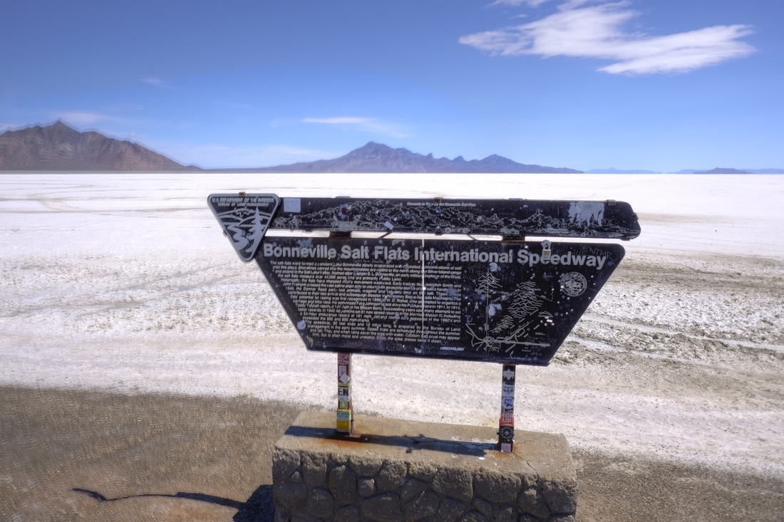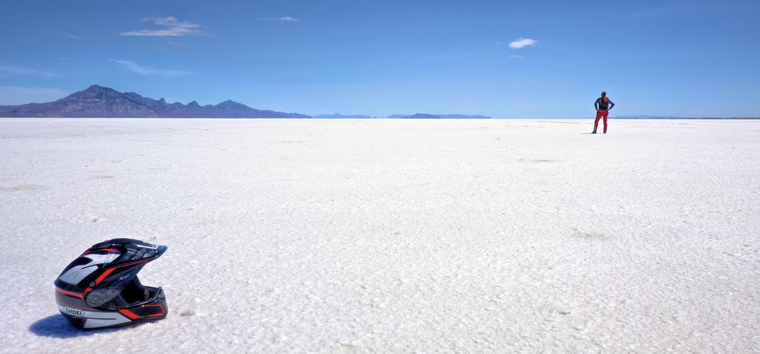
Fittingly, today began with burning its first tank up speeding down the 80 mph I-80 to check out the Bonneville Salt Flats and Speedway. Although there is nothing going on this time of year, this was still a worthwhile sightseeing stop, with cool visual perspectives and just enough other tourists to keep it interesting. Most importantly, there was a Sinclair station at the speedway exit, so I didn't have to cross the state line into forbidden Nevada to fill up on dead dinosaurs. Or to get a sticker.
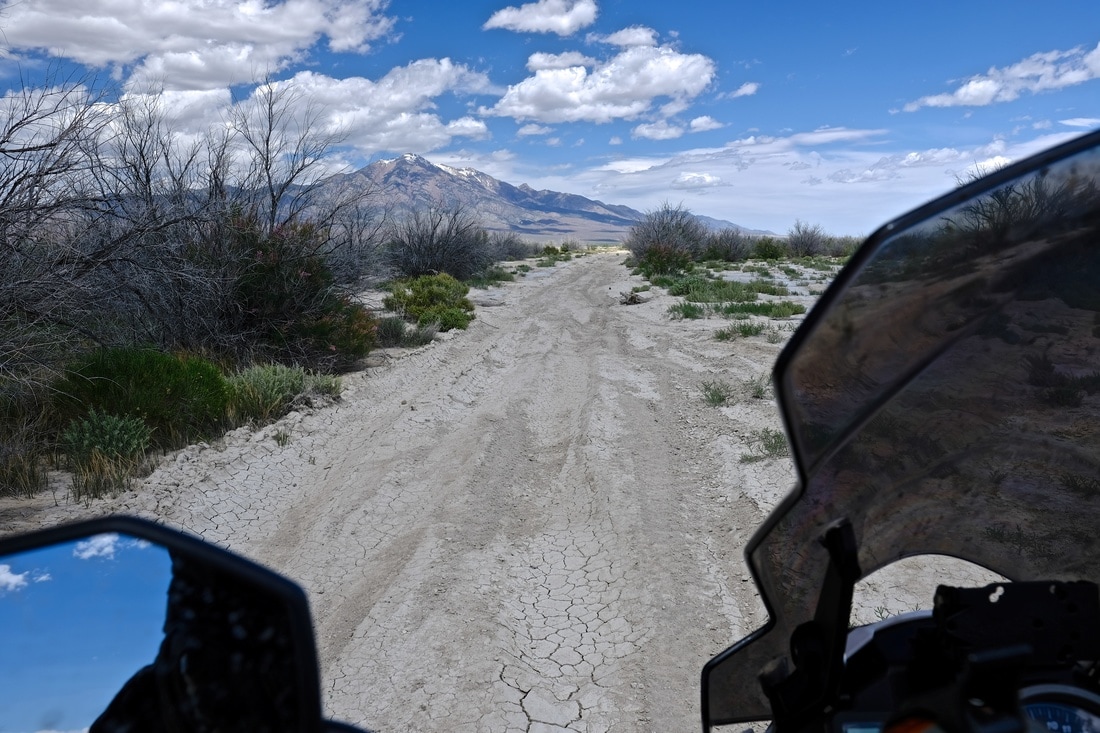
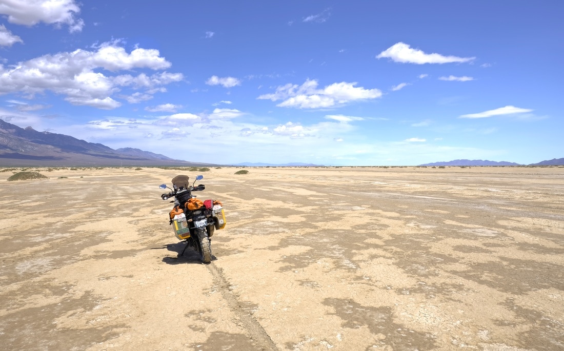
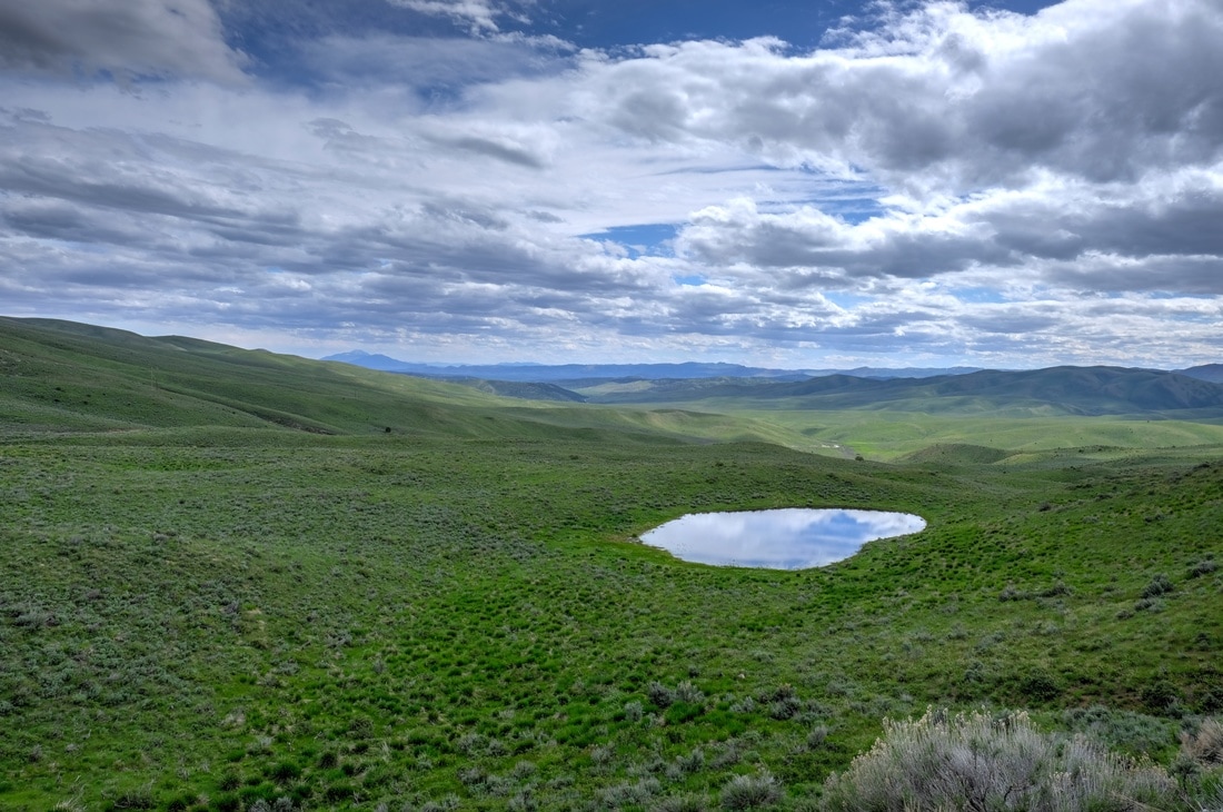
From the Speedway exit, rather than returning to the interstate, I turned north and plugged into a direct route to Idaho which I had scoped out based on marked roads from Butler's map. (There weren't a whole lot of options north from Bonneville which did not involve (a) backtracking, or (b) Nevada.) I had worked through the detailed navigation steps with Google Maps over breakfast, and emailed a copy of my plan to my brother so that someone knew my intentions. So, with that, off I went north in search of the four-way intersection to hopefully identify Irrigation Aqueduct Road. The first 20 km was less of a 'road' than I'd anticipated, and rather was more of a maintained trail consisting of deep, soft gravel spread on sand. On two different occasions, the softness of it caused me to stop and contemplate U-turning. However, I told myself that, as long as I didn't ride through anything I couldn't ride back out of, I would push onward to the 24 km mark, where I knew my route turned right onto a different road, and if the surface didn't improve then, I would abort back to interstate rather than hundreds of kilometers of this. So I picked my way through it, riding at the edges of the gravel where possible, and foot-paddling my way through it in 1st gear (or 0.5 gear) for portions as needed. I was rewarded with a transition to salt-crusted sand for I think what counts as a bona fide moto crossing of a portion of the salt flats itself! As hoped, after my right turn, the trail -- and my route -- intersected with a good gravel road, which remained the norm all the way to Potatoland.
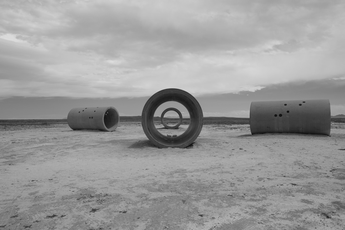
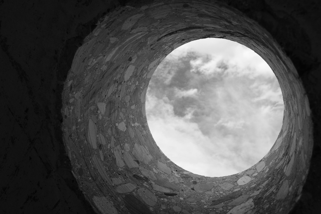
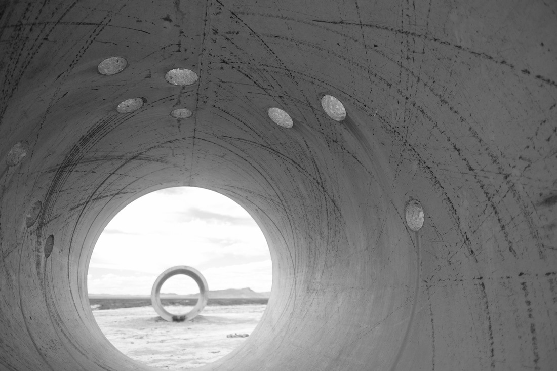
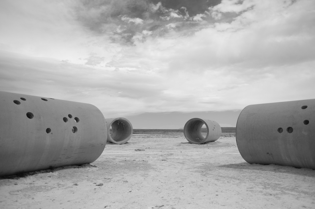
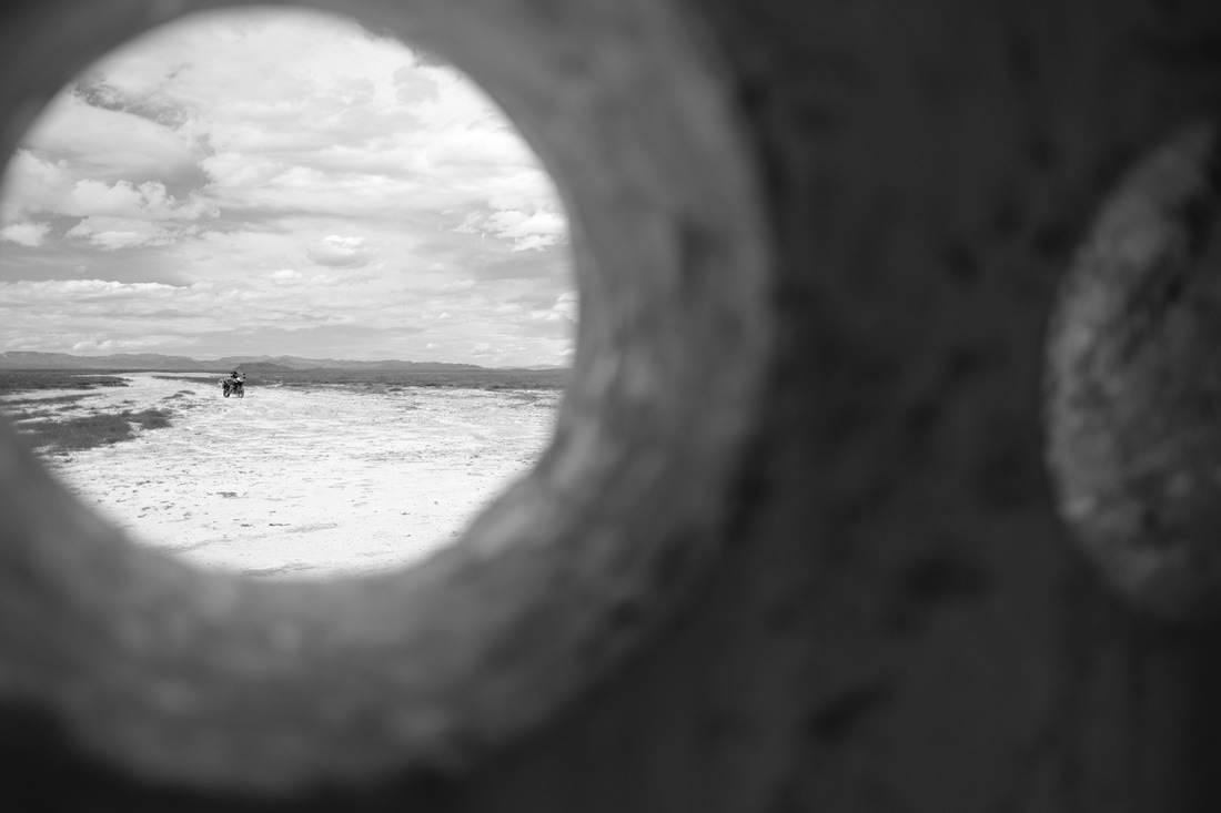
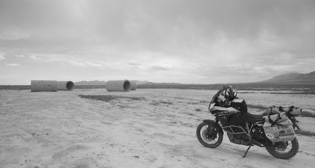
I continued north past TL Bar Ranch, shortly before Lucin stumbling across an enigmatic art installation called the Sun Tunnels. Well, technically I'd stumbled across it while Googling my route details over morning coffee, but I had to stumble across it again for real in the field, because it's completely unmarked, unsigned, and is literally just in a field! The installation consists of 4 large concrete cyclinders, maybe 8 feet in diameter, which are laying horizontally on the ground and arranged in an 'X' pattern, oriented such that the sunrise and sunset at this location pass through one of the respective pairs of cylinders on the summer solstice, and through the other pair on winter solstice. Rather ingenious, and totally random to stumble across. I spend about twenty minutes here, shooting in the wonderful Fujifilm ACROS black & white rendition, and thoughts of a heightened sense of awareness of the solstices since moving north, and of my physics teacher Dad. Serenity score: 'A.'
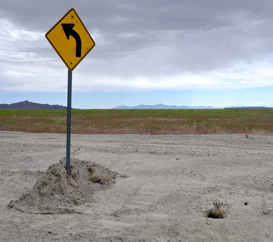
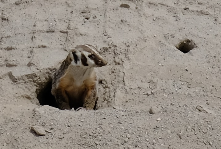
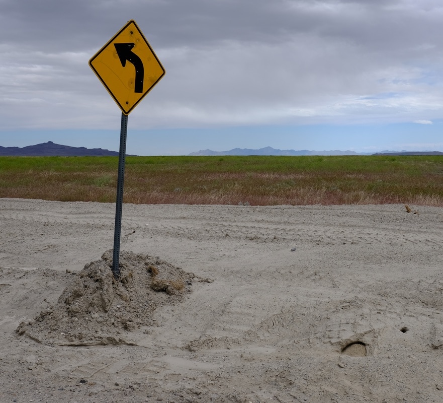
I maintained due north on the gravel. Just before the Lucin railway crossing, I saw two furry things scamper off the road to the right ditch. I slowed and stopped to check it out. Would you believe... BADGERS! Yes folks, a real, live badger sighting. Even in the moment I thought they were badgers, and a bit of internet research totally confirms it. I believe this was the American Badger, and because I saw two, it was likely a couple, likely with some youngins nearby. One of the two was particularly curious, and repeatedly kept poking his/her head out of the burrow, to check me out. I worked up the nerve to kill my motor, and summoned my calm-down-you-crazy-dog nature voice to talk nonthreateningly to it, hopeful to get a full-body picture. However, after posing for a few headshots over the span of probably four minutes, there was a flurry of dust, and dirt started flying inside the hole, and before I could figure out what was happening, the badger had thrown up a totally effective defensive barricade dirt mound filling the entrance. Not sure if I totally scared the little furball, or if this is commonplace, just how badgers close the front door. Alas, very cool, and I'm glad I didn't drop my bike!
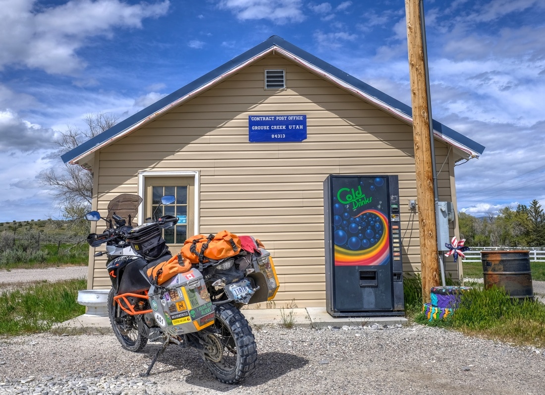
I crossed Highway 30 and continued north on good gravel through Grouse Creek and Lynn, coming out in Oakley, Idaho. This was beautiful ranchland, and I have a vision burned on my retinas of two different lone horses which I saw in fields alongside the road. Both were very shy, and scampered long before any hope of a photo. I believe they were domesticated, but boy were they beautiful. Aside from the badgers and almost-wild horses, today's wildlife report also includes snakes trying to cross the road, and mice -- so many mice -- on Grouse Creek road. (Badgers, snakes, and mice... this sounds like an interconnected ecosystem.)
Oakley proved to be a bust (searched all of main street for the sunglasses factory outlet, to no avail). I got caught in more construction delays southeast of Twin Falls, but pounded pavement to finish the evening, up through Sun Valley (where it turns out every police car in the American southwest is hanging out; I saw at least six, after seeing exactly none over my five days in Utah) (does Utah have police?), over chilly Galena Summit, and finishing up along the Salmon River headwaters valley, where conditions were an uncomfortable +4 C with light rain and heavy deer.
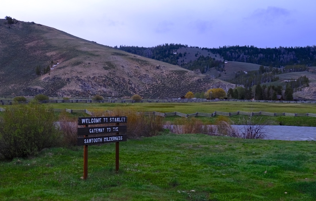
The good people of the Sawtooth Hotel in Stanley once again took me in as they did in 2014, as a cold late arrival, quickly cared for with parking in back, a big bowl of soup, and a fantastic meal. (Meat loaf with some kind of avocado/green chile sauce, veggies, and a Sawtooth Brewery IPA.) I checked my email and found confirmation that my tire change is organized in Calgary for 9:00am Saturday. The power went out just as I was crawling into bed and about to kill the lights myself.
From the Speedway exit, rather than returning to the interstate, I turned north and plugged into a direct route to Idaho which I had scoped out based on marked roads from Butler's map. (There weren't a whole lot of options north from Bonneville which did not involve (a) backtracking, or (b) Nevada.) I had worked through the detailed navigation steps with Google Maps over breakfast, and emailed a copy of my plan to my brother so that someone knew my intentions. So, with that, off I went north in search of the four-way intersection to hopefully identify Irrigation Aqueduct Road. The first 20 km was less of a 'road' than I'd anticipated, and rather was more of a maintained trail consisting of deep, soft gravel spread on sand. On two different occasions, the softness of it caused me to stop and contemplate U-turning. However, I told myself that, as long as I didn't ride through anything I couldn't ride back out of, I would push onward to the 24 km mark, where I knew my route turned right onto a different road, and if the surface didn't improve then, I would abort back to interstate rather than hundreds of kilometers of this. So I picked my way through it, riding at the edges of the gravel where possible, and foot-paddling my way through it in 1st gear (or 0.5 gear) for portions as needed. I was rewarded with a transition to salt-crusted sand for I think what counts as a bona fide moto crossing of a portion of the salt flats itself! As hoped, after my right turn, the trail -- and my route -- intersected with a good gravel road, which remained the norm all the way to Potatoland.
I continued north past TL Bar Ranch, shortly before Lucin stumbling across an enigmatic art installation called the Sun Tunnels. Well, technically I'd stumbled across it while Googling my route details over morning coffee, but I had to stumble across it again for real in the field, because it's completely unmarked, unsigned, and is literally just in a field! The installation consists of 4 large concrete cyclinders, maybe 8 feet in diameter, which are laying horizontally on the ground and arranged in an 'X' pattern, oriented such that the sunrise and sunset at this location pass through one of the respective pairs of cylinders on the summer solstice, and through the other pair on winter solstice. Rather ingenious, and totally random to stumble across. I spend about twenty minutes here, shooting in the wonderful Fujifilm ACROS black & white rendition, and thoughts of a heightened sense of awareness of the solstices since moving north, and of my physics teacher Dad. Serenity score: 'A.'
I maintained due north on the gravel. Just before the Lucin railway crossing, I saw two furry things scamper off the road to the right ditch. I slowed and stopped to check it out. Would you believe... BADGERS! Yes folks, a real, live badger sighting. Even in the moment I thought they were badgers, and a bit of internet research totally confirms it. I believe this was the American Badger, and because I saw two, it was likely a couple, likely with some youngins nearby. One of the two was particularly curious, and repeatedly kept poking his/her head out of the burrow, to check me out. I worked up the nerve to kill my motor, and summoned my calm-down-you-crazy-dog nature voice to talk nonthreateningly to it, hopeful to get a full-body picture. However, after posing for a few headshots over the span of probably four minutes, there was a flurry of dust, and dirt started flying inside the hole, and before I could figure out what was happening, the badger had thrown up a totally effective defensive barricade dirt mound filling the entrance. Not sure if I totally scared the little furball, or if this is commonplace, just how badgers close the front door. Alas, very cool, and I'm glad I didn't drop my bike!
I crossed Highway 30 and continued north on good gravel through Grouse Creek and Lynn, coming out in Oakley, Idaho. This was beautiful ranchland, and I have a vision burned on my retinas of two different lone horses which I saw in fields alongside the road. Both were very shy, and scampered long before any hope of a photo. I believe they were domesticated, but boy were they beautiful. Aside from the badgers and almost-wild horses, today's wildlife report also includes snakes trying to cross the road, and mice -- so many mice -- on Grouse Creek road. (Badgers, snakes, and mice... this sounds like an interconnected ecosystem.)
Oakley proved to be a bust (searched all of main street for the sunglasses factory outlet, to no avail). I got caught in more construction delays southeast of Twin Falls, but pounded pavement to finish the evening, up through Sun Valley (where it turns out every police car in the American southwest is hanging out; I saw at least six, after seeing exactly none over my five days in Utah) (does Utah have police?), over chilly Galena Summit, and finishing up along the Salmon River headwaters valley, where conditions were an uncomfortable +4 C with light rain and heavy deer.
The good people of the Sawtooth Hotel in Stanley once again took me in as they did in 2014, as a cold late arrival, quickly cared for with parking in back, a big bowl of soup, and a fantastic meal. (Meat loaf with some kind of avocado/green chile sauce, veggies, and a Sawtooth Brewery IPA.) I checked my email and found confirmation that my tire change is organized in Calgary for 9:00am Saturday. The power went out just as I was crawling into bed and about to kill the lights myself.
| Day total: 690 km, 10h40m Trip total: 7,763 km | Start: Lake Point, UT. End: Stanley, ID. Soundtrack: terrible shuffle, Diga's "Forest Fire," Mr. Thornley's "Secrets," k-os. |