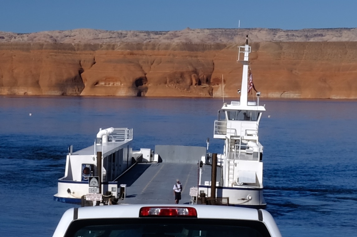
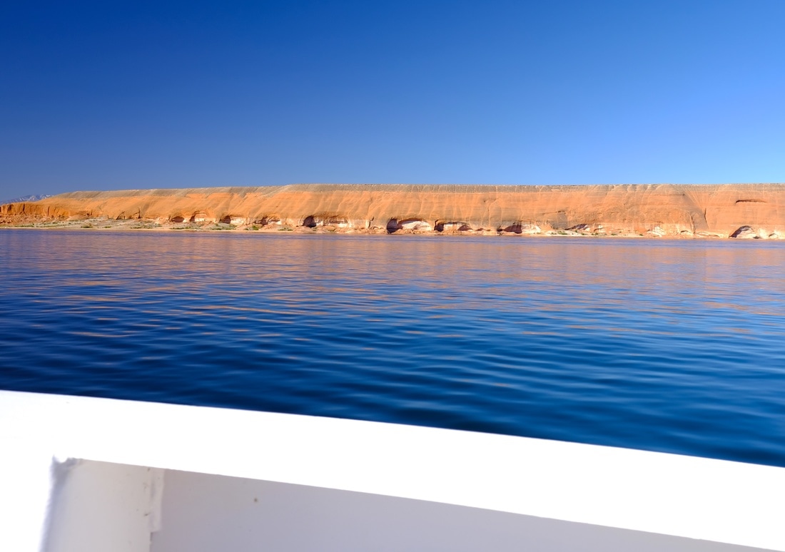
I woke up to a 7:30 alarm, to get me to the first ferry south at 9:00 and, despite the hotel kitchen staff's attempts to make me miss the sailing due to pancakes, I was second in line of an ultimate crowd of three vehicles for Tuesday's first trip across Powell Lake.
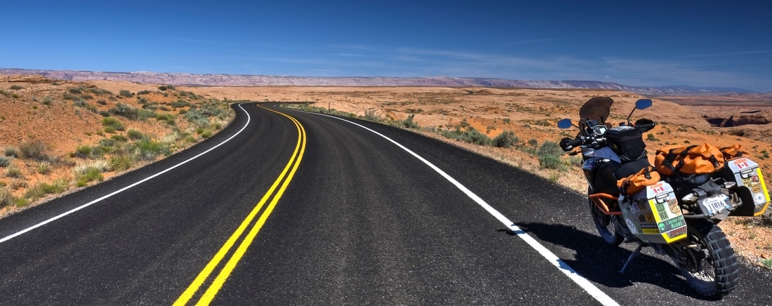
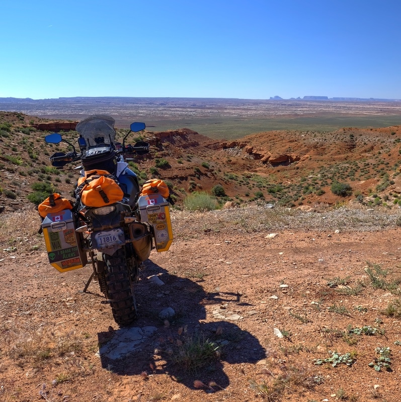
I followed the (fun) 276 east, through a series of sweet 70-mph sweepers leaving Glen Canyon National Rec Area. The first time I remember seeing Monument Valley was on a 2004 Christmas card from Muller Windsports, picturing Chris Muller flying a paraglider amidst the most incredible rock formations. Today, my heart got a bit giddy when I caught my first glimpse of the real thing, descending the 276 out of Clay Hills Pass and seeing the unmistakable silhouette of Monument Valley on the southern horizon. I pulled over for a drink of water, and also decided to finally find 10 minutes to install Badger's kickstand foot enlarger. Kind of a random location for a farkle, but the view was good.
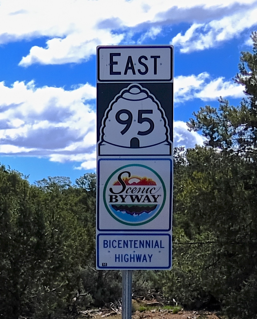
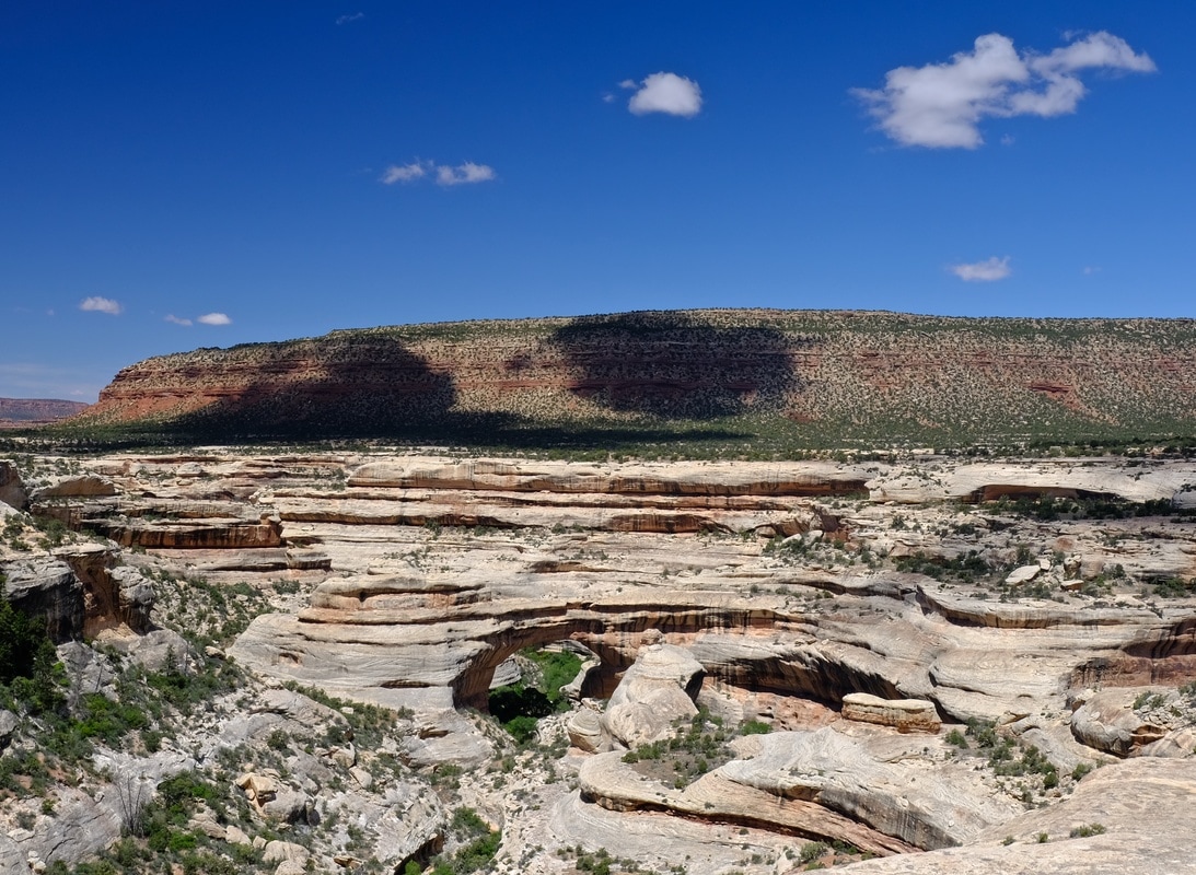
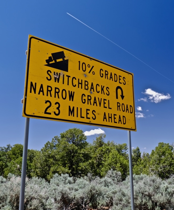
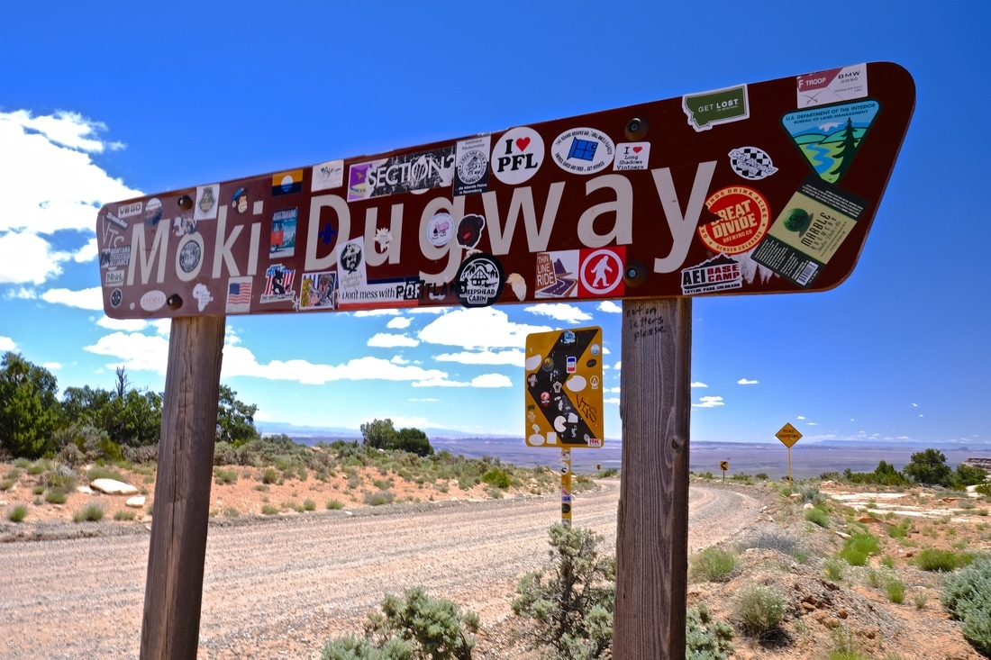
The 276 then ripped me 30km further away from that horizon, east to the 95, where I diverted into the Natural Bridges national park to check it out. It consists of viewpoints over three natural bridge rock formations, interconnected by a one-lane, one-way, 15-km long paved track. Butler scored the effective go-cart track as G1, and it was. On my way out, there were three other BMW riders in the visitor centre pleading to make a donation in order to score some gas. (They succeeded.) From there, I shot south on 261, through the switchbacks of Moki Dugway, below which I followed a sign to turn left for Valley of the Gods.
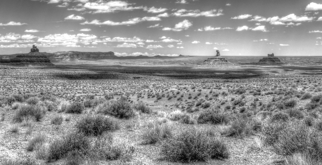
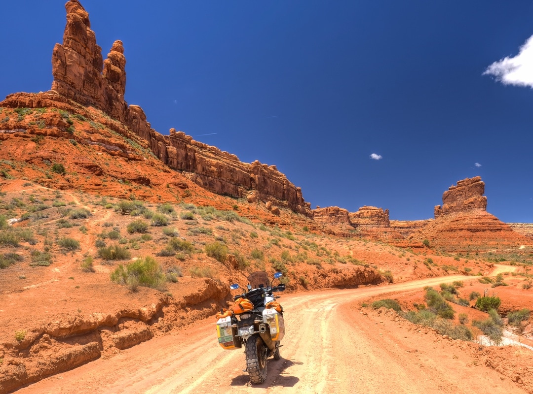
Valley of the Gods has a 17-mile dirt track winding through it, which was a ride I will not soon forget. The scenery through this area is unlike anything I've seen anywhere else. I'll let the pictures illustrate, but I guess I'd summarize the feeling while riding through the fantastical alien land as one of smallness and of geological youthfulness-bordering-on-insignificance. Maybe my helmet was too tight. Regardless, serenity rating A- (deduction only for the presence of the few others).
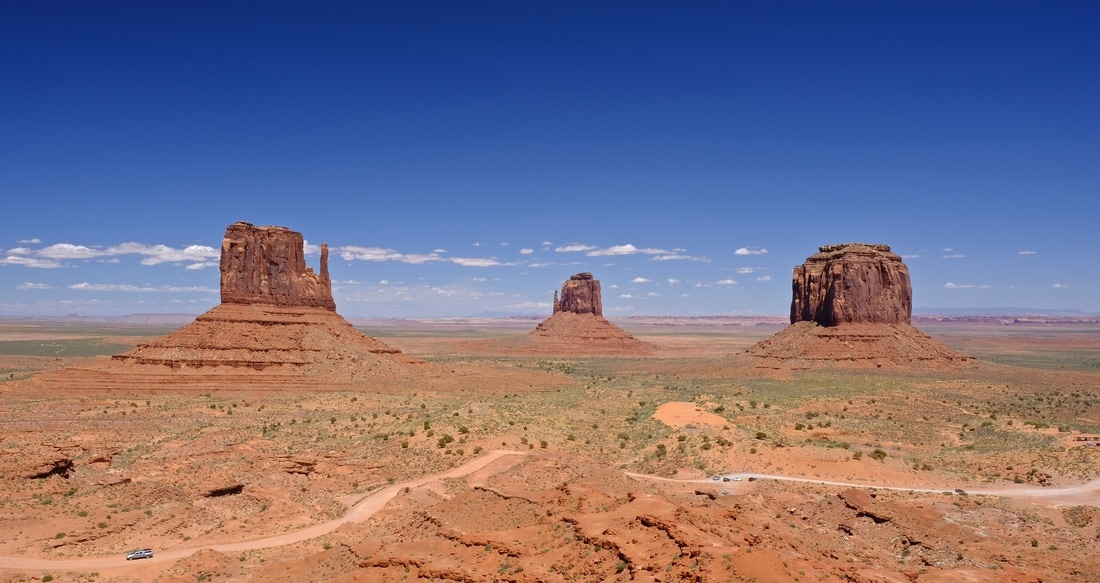
The VotG trail dumped me directly on the 163, which I followed south into Mexican Hat (a town named after an elevated rock formation that looks like an upside-down sombrero). I punched "Moab" into my GPS, determined a calculated ETA of 3:50pm, so calculated that I could afford one more hour exploring south into Monument Valley, which with the backtrack would get me into Moab for 6:00. Before I knew it, I found myself on the long straight road descending to the classic horizon outline, the exact scene which I'd vowed to my sweetheart that I would find after seeing a photo of it on Flickr before I left home. Woohoo! I carried on to the Navajo Monument Valley Park entrance, where I paid a $10 entrance fee just to be told that the dirt track through the three big monoliths is forbidden to motorcycles. I got over it, and drank a liter of water sitting at the overlook at the visitor centre, then applied my admission privileges to give the park more dollars, buying a pannier sticker in the gift shop. Serenity rating, C.
When I charted my route across Utah, I was quite conflicted to try to fit Monument Valley alongside the other can't-miss parks of southern Utah, as they are literally alongside each other and I'm meant to be moving north. In the end, I reversed my initial vision, exiting Arizona to the northwest rather than into Monument Valley in the northeast. As I backtracked to Mexican Hat, and as the landscape of red rock formations disappeared seemingly instantly, exchanging for plain old grassland hills, I reflected on a feeling of genuine satisfaction that I'd been able to get to Utah's southwest corner after all. My mood soured as I continued north, mainly due to physical discomfort, and by Blanding, with a headache, a gusty crosswind off of my left shoulder, another sore ear, a full bladder, and seemingly every side road off the highway gated closed, I was at my "ready" point, so pulled into a roadside rest area, took off my helmet and jacket, and sat on a bench for 10 minutes and ate a Snickers. Upon stopping, I did indeed find an extra fold in my Buff which was making my helmet squeeze, and I also discovered removable foam pieces in my helmet to make more space for earpieces, but in hindsight I equally just needed a mental timeout.
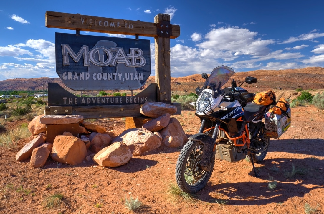
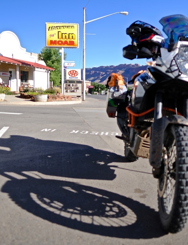
The last hour north into Moab turned scenic again, and got me decidedly looking forward to a slight break from routine with a planned maintenance morning ahead. I found fantastic Thai food at Arches Thai, then holed up early to prepare for more arches at dawn.
The 276 then ripped me 30km further away from that horizon, east to the 95, where I diverted into the Natural Bridges national park to check it out. It consists of viewpoints over three natural bridge rock formations, interconnected by a one-lane, one-way, 15-km long paved track. Butler scored the effective go-cart track as G1, and it was. On my way out, there were three other BMW riders in the visitor centre pleading to make a donation in order to score some gas. (They succeeded.) From there, I shot south on 261, through the switchbacks of Moki Dugway, below which I followed a sign to turn left for Valley of the Gods.
Valley of the Gods has a 17-mile dirt track winding through it, which was a ride I will not soon forget. The scenery through this area is unlike anything I've seen anywhere else. I'll let the pictures illustrate, but I guess I'd summarize the feeling while riding through the fantastical alien land as one of smallness and of geological youthfulness-bordering-on-insignificance. Maybe my helmet was too tight. Regardless, serenity rating A- (deduction only for the presence of the few others).
The VotG trail dumped me directly on the 163, which I followed south into Mexican Hat (a town named after an elevated rock formation that looks like an upside-down sombrero). I punched "Moab" into my GPS, determined a calculated ETA of 3:50pm, so calculated that I could afford one more hour exploring south into Monument Valley, which with the backtrack would get me into Moab for 6:00. Before I knew it, I found myself on the long straight road descending to the classic horizon outline, the exact scene which I'd vowed to my sweetheart that I would find after seeing a photo of it on Flickr before I left home. Woohoo! I carried on to the Navajo Monument Valley Park entrance, where I paid a $10 entrance fee just to be told that the dirt track through the three big monoliths is forbidden to motorcycles. I got over it, and drank a liter of water sitting at the overlook at the visitor centre, then applied my admission privileges to give the park more dollars, buying a pannier sticker in the gift shop. Serenity rating, C.
When I charted my route across Utah, I was quite conflicted to try to fit Monument Valley alongside the other can't-miss parks of southern Utah, as they are literally alongside each other and I'm meant to be moving north. In the end, I reversed my initial vision, exiting Arizona to the northwest rather than into Monument Valley in the northeast. As I backtracked to Mexican Hat, and as the landscape of red rock formations disappeared seemingly instantly, exchanging for plain old grassland hills, I reflected on a feeling of genuine satisfaction that I'd been able to get to Utah's southwest corner after all. My mood soured as I continued north, mainly due to physical discomfort, and by Blanding, with a headache, a gusty crosswind off of my left shoulder, another sore ear, a full bladder, and seemingly every side road off the highway gated closed, I was at my "ready" point, so pulled into a roadside rest area, took off my helmet and jacket, and sat on a bench for 10 minutes and ate a Snickers. Upon stopping, I did indeed find an extra fold in my Buff which was making my helmet squeeze, and I also discovered removable foam pieces in my helmet to make more space for earpieces, but in hindsight I equally just needed a mental timeout.
The last hour north into Moab turned scenic again, and got me decidedly looking forward to a slight break from routine with a planned maintenance morning ahead. I found fantastic Thai food at Arches Thai, then holed up early to prepare for more arches at dawn.
| Day total: 524 km, 9h35m Trip total: 6,362 km | Start: Bullfrog, UT. End: Moab, UT. Soundtrack: AWOLNATION, Xavier Rudd, foam plugs due to Tender Ears |